|
A few words about the name Troodos...
 The formation of Cyprus is directly linked to the creation of the Troodos mountain range, as a result of a series of unique and complex geological processes which have made Cyprus a geological model for researchers from around the world, contributing to a better understanding of the development of the oceans and of the planet in general. The formation of Cyprus is directly linked to the creation of the Troodos mountain range, as a result of a series of unique and complex geological processes which have made Cyprus a geological model for researchers from around the world, contributing to a better understanding of the development of the oceans and of the planet in general.
Neither the residents of Cyprus nor the island's foreign visitors would ever suspect that the wooded peak of Troodos is actually the deepest layer of a section of oceanic crust and the Earth's upper mantle. In other words, an ophiolite complex that was formed 90 million yearsago, 8,000 metres below sea level.
The Troodos Geopark is located in the central part of Cyprus and its area is approximately 137,000 hectares (1,370 sq.m.), covering 45% of the total area of the Troodos range and 15% of the total areaof Cyprus.
Administratively, the area forms part of three districts – Nicosia, Paphos and Limassol - and covers the altitude from 300 metres to the highest peak, Mount Olympus, which stands at 1,952m above sea level. It includes 110 communities with a total population of approximately 25,000 residents. The region combines enormous geological interest with the unique natural environment of Troodos, a long history of human settlements and the population’s local customs and traditions.
Suggested Tours
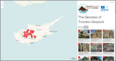
| The Geosites of Troodos Geopark |
Tours in Troodos Geopark |
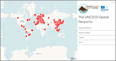
The UNESCO Global Geoparks |
 |
 |
 |
For more information for geology, mines , geosites and trails of Troodos Geopark Area you can browse the following links:
Our News
Photos
Video
|